Welcome. Are you looking for geospatial data processing solutions to support decision-making in land management, agriculture, environment, or urban planning? Ground Data Technology Solutions Joint Stock Company (GDTS) provides comprehensive geospatial data processing and analysis services, helping you maximize the value of collected data.
UAV and Remote Sensing Data Processing
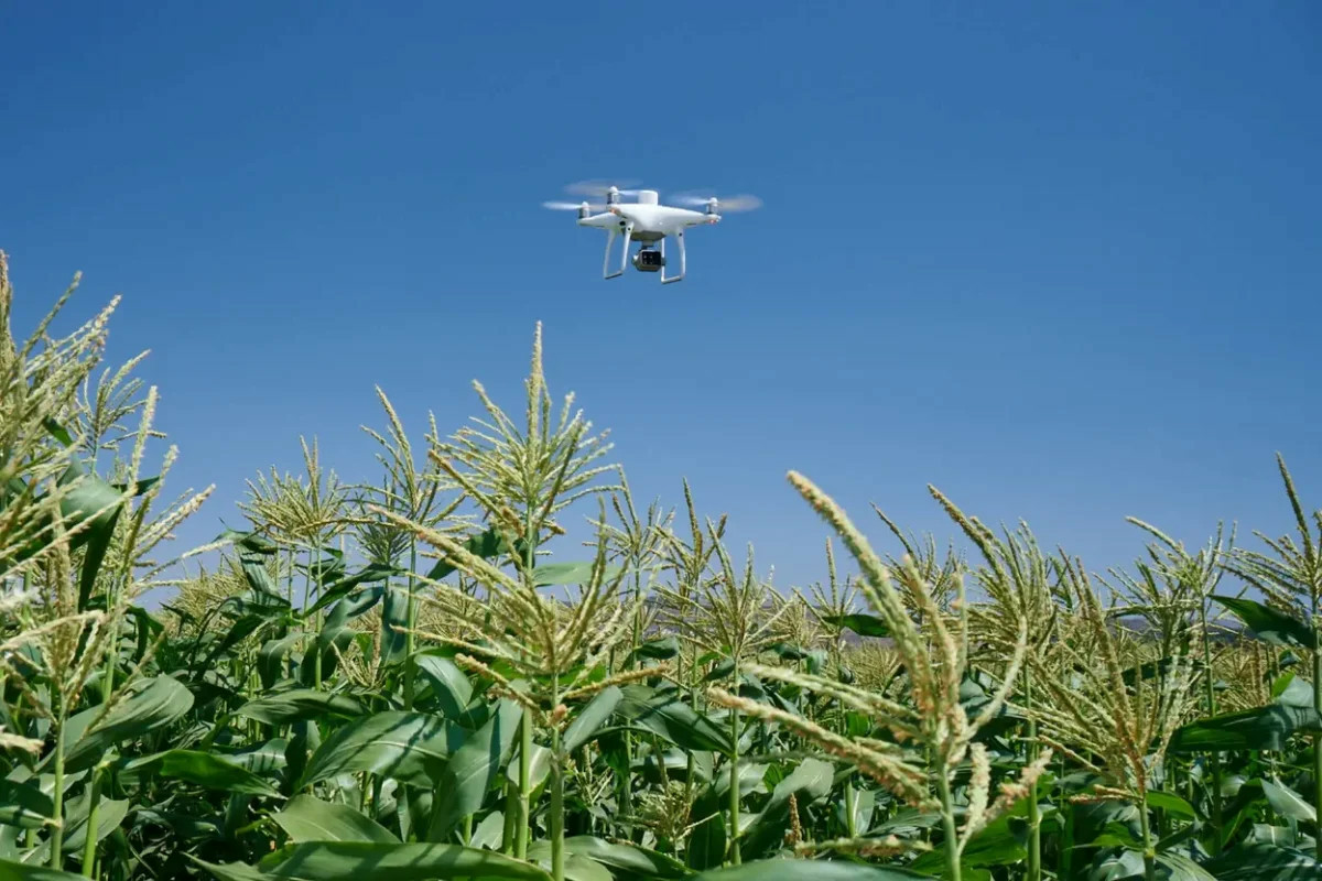
GDTS processes data from unmanned aerial vehicles (UAVs) and satellite imagery to produce high-accuracy geospatial products. The processing pipeline includes geometric correction, digital elevation model generation (DEM/DSM), orthophoto production, and multispectral mapping for in-depth analysis.
GIS Development and Spatial Analysis

We build GIS databases and perform spatial analyses on demand: buffer analysis, map overlay, network analysis, spatial interpolation, and geographic modeling. Results are presented as thematic maps, dashboards, or integrated reports — enabling clients to make well-informed decisions with ease.
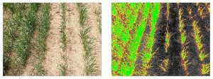
Change Detection and Environmental Monitoring
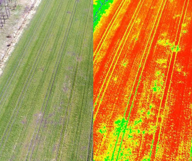
By comparing geospatial data over time, GDTS supports the detection and quantification of changes in land use, vegetation cover, soil erosion, and water pollution. Common applications include agricultural monitoring, forest management, flood control, and environmental impact assessment.
Thematic Mapping and Data Visualization
GDTS designs and publishes thematic maps meeting technical standards specified by clients. We also develop interactive data visualization tools (web GIS, spatial dashboards) that allow clients to monitor and share geographic information in an intuitive and efficient manner.
Consulting and Decision Support
With a team of geospatial specialists, GDTS goes beyond data processing to provide analytical consulting services. We work alongside clients to identify the most appropriate analysis methods, interpret results, and apply geospatial insights to strategic decisions — from raw material zone planning and natural disaster risk assessment to logistics optimization.
For more information about the Geospatial Data Analyze service, please contact us.