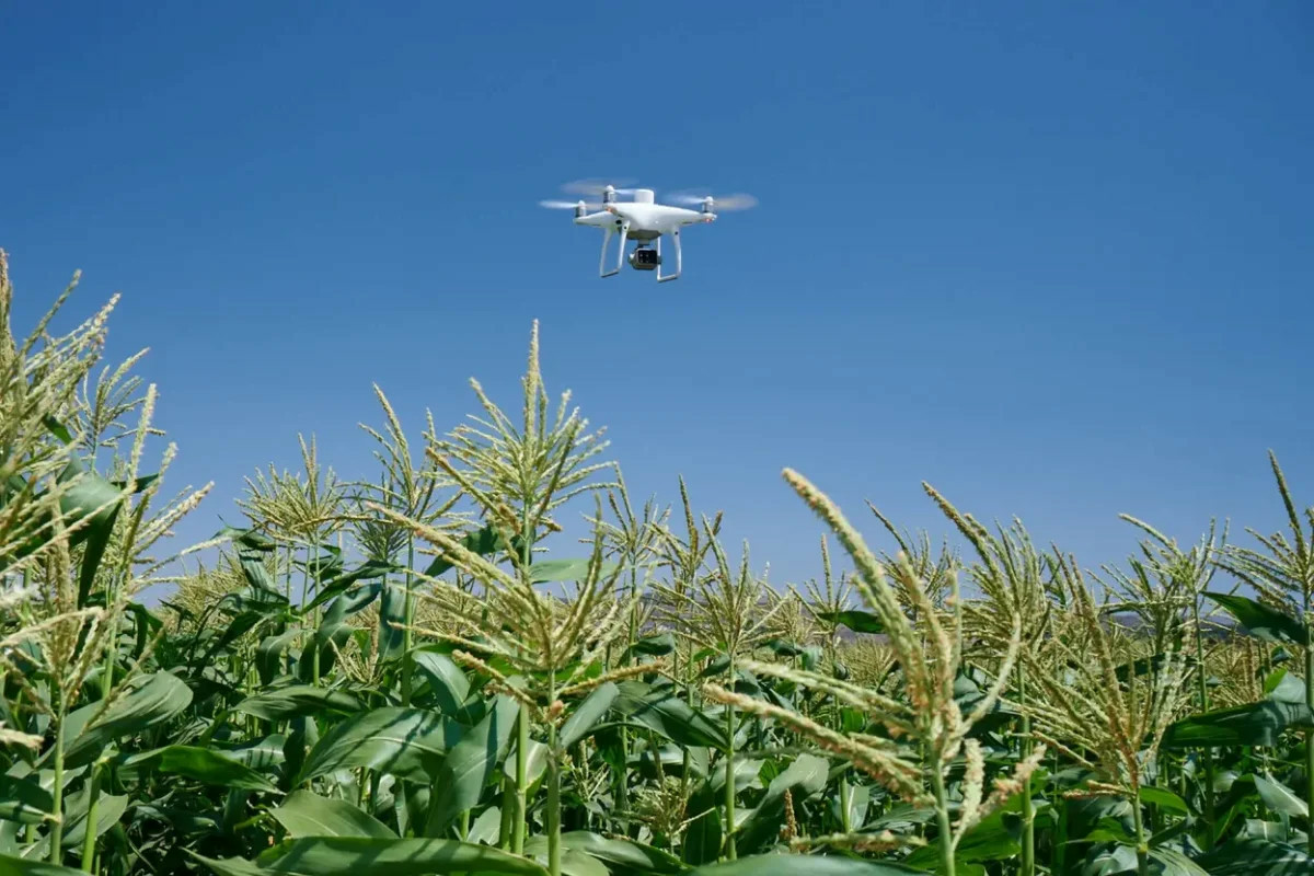
As organic agricultural products continue to expand in both yield and area, monitoring product quality alongside geographical indicators is critically important. Unmanned aerial vehicles (UAVs) perform agricultural monitoring, assessment, analysis, and management through the use of Multispectral cameras mounted on UAVs, helping farmers and engineers better understand the condition of their crops.
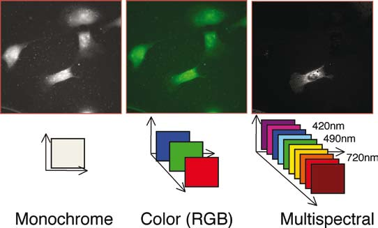
A multispectral camera features an imaging system consisting of one standard camera and five sensors at different wavelengths — including red, blue, green, red-edge, and near-infrared — capable of capturing both visible and infrared light wavelengths.
Image data captured during flights is analyzed by experts for plant health, soil composition, as well as water salinity and contamination. In addition, certain spectral sensor types are capable of maximizing the accuracy and consistency of data collection for survey flights conducted at different times of the day.
Although the application of Multispectral technology across production and daily life sectors delivers significant benefits — greatly reducing labor while maintaining high accuracy — this technology is still relatively new in Vietnam, and its use has not yet been widely adopted or well known. GDTS is proud to offer services related to Multispectral applications to our clients. Some notable applications of Multispectral already in practical use in agriculture in advanced countries include:
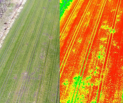
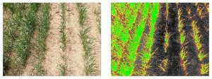
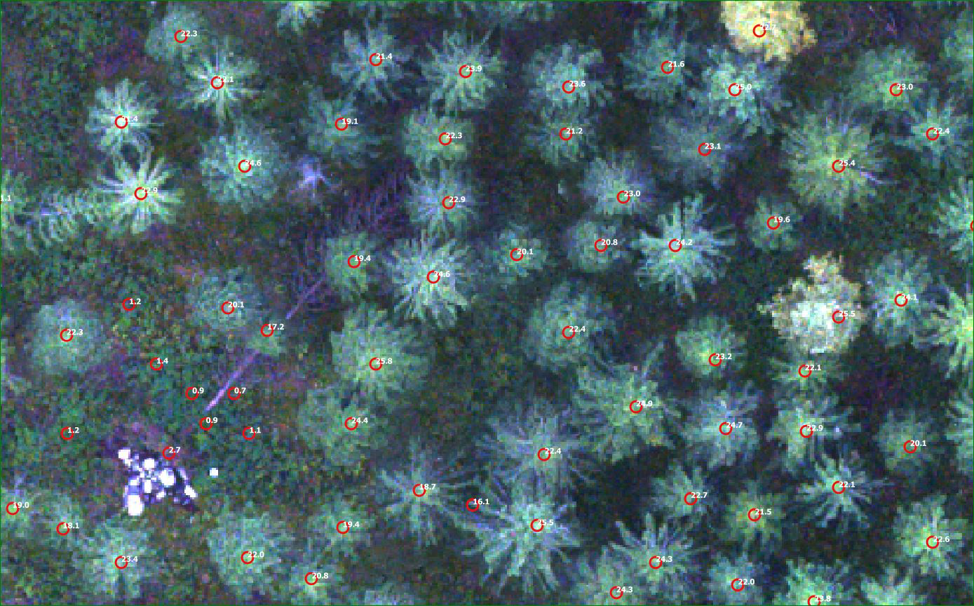
In Agriculture, Multispectral is used to survey, monitor, and map crop health, identify disease and weed outbreaks, map urban greenery and vegetation based on RGB indices, determine the quantity and classification of plants, and more. Multispectral imagery can be invaluable to agricultural professionals by providing information invisible to the naked eye — through secondary indices such as NDRE and NDVI — allowing them to make timely, informed decisions about crop treatment, reduce costs, conserve resources, and maximize yields.
Aerial imagery alone is not sufficient for the requirements of agricultural specialists. Switching between NDVI index analysis and live RGB data feeds enables immediate identification of areas requiring attention, allowing specialists to quickly make treatment decisions.
In Environmental Monitoring and Inspection, Multispectral also has significant applications in managing and assessing the level of environmental pollution based on water color, checking for leaks, and managing water appropriately for crop types to avoid waste. It can also manage riparian vegetation while protecting habitats or ecosystems.
In Forestry, routine plant care inspections can be performed more intelligently and efficiently using Multispectral — leveraging multifaceted insights to monitor forest health, measure biomass, and map shorelines.
Drones in general and Multispectral in particular are gradually revolutionizing farmers' daily cultivation practices. A technology-driven agricultural trend is steadily emerging in Vietnam, promising to bring benefits across many dimensions at the lowest cost and highest efficiency — producing higher yields with fewer inputs.
For more information about the Agricultural Data Collection service, please contact us.